Learn positions and navigation with NautiPy
NautiPy turns coordinate text into validated positions, performs common WGS 84 navigation calculations, and estimates a position from bearings and ranges. This site explains the ideas as well as the Python.
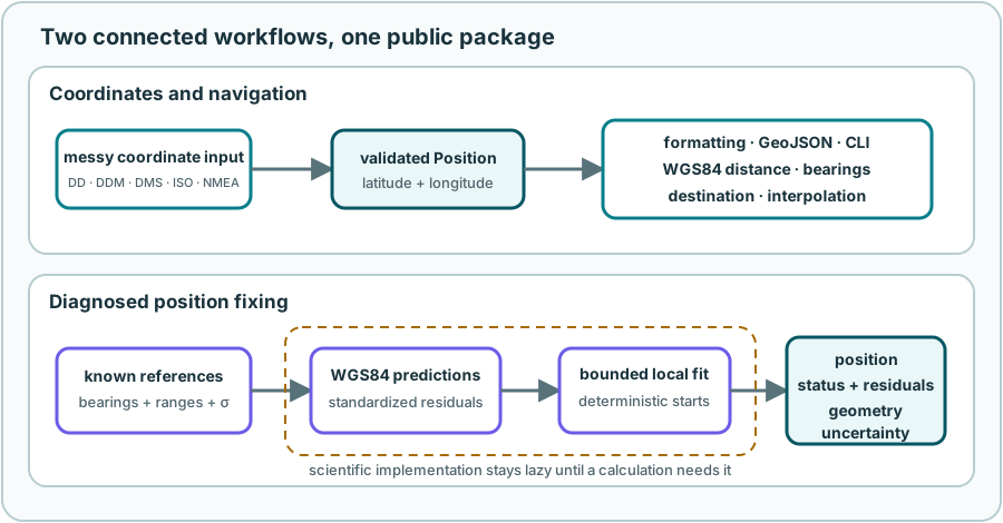
There are two connected journeys:
- Coordinates to navigation: read a position safely, then calculate a distance, bearing, destination, or point along a route.
- Observations to a fix: combine bearings and ranges to known references, then examine whether the resulting position is unique and trustworthy.
Install the complete package
One installation provides coordinate handling, navigation, GeoJSON, the command line, and position fixing. Ordinary calculations are offline.
Your first position
People write the same location in many ways. NautiPy recognizes decimal degrees (DD), degrees and decimal minutes (DDM), degrees/minutes/seconds (DMS), a two-dimensional subset of ISO 6709, and NMEA coordinate fields.
from nautipy import convert_position, parse_position

position = parse_position("N 50° 7' 21.252\"; E 8° 39' 56.52\"")

print(position.latitude, position.longitude)
print(convert_position(position, to="ddm"))
The result is an immutable Position in decimal degrees. NautiPy normalizes
harmless presentation differences, but it does not guess between two
different places.
Your first WGS84 calculation
An initial bearing of 90° points due east at the start. A destination 12 km away is:
from nautipy import destination, inverse

start = "50.12257, 8.66570"
end = destination(start, bearing=90, distance=12_000)
journey = inverse(start, end)

print(end)
print(journey.distance)          # metres
print(journey.initial_bearing)   # true degrees
print(journey.final_bearing)     # true forward bearing on arrival
The path is a shortest geodesic on the WGS84 ellipsoid, not a straight line on a flat map or a great circle on a perfect sphere.
Explore ellipsoidal navigation →
Your first position fix
Suppose three known stations report surface ranges to a boat. Each observation also carries a one-standard-deviation uncertainty, because metre and degree errors need meaningful weights.
from nautipy import Position, RangeObservation, solve_fix

references = (
    Position(50.116135, 8.670277),
    Position(50.112836, 8.666753),
    Position(50.110347, 8.659873),
)
ranges = tuple(
    RangeObservation(reference, measured, uncertainty=2.0)
    for reference, measured in zip(
        references,
        (1_275.251, 1_599.237, 1_917.145),
    )
)

result = solve_fix(ranges=ranges)
if result.success:
    print(result.position)
    print(result.warnings)
else:
    print(result.status, result.message)
    print(result.competing_positions)
The complete FixResult matters. It reports convergence, residuals, geometry,
ambiguity, and a local uncertainty estimate where meaningful.
Choose a path
- Coordinates on Earth explains notation, order, and why printed precision is not accuracy.
- Navigation on an Ellipsoid introduces inverse and direct geodesic problems.
- Finding the Boat builds bearing and range fixes from geometry.
- Can You Trust the Fix? teaches residuals, conditioning, statuses, and uncertainty.
- Fix Lab lets you compare precomputed observation scenarios.
- Practical Use collects small recipes for Python, GeoJSON, and the command line.
- How NautiPy Works follows both workflows through the package.
- Glossary and Further Reading connect the concepts to approachable introductions and primary sources.
Navigation safety
NautiPy is an educational calculation library, not certified navigation equipment. Its results are only as good as the supplied coordinates, observations, uncertainty assumptions, datum, and model. Do not use it as the sole source for safety-critical navigation.